 vesseltracker.com
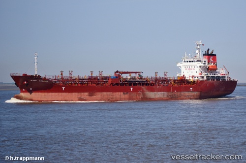
Vessel ROCKY IMO: 9196448, MMSI: 649129000 Oil/Chemical Tanker
UTC, 27.57972, 34.19639, course: 328, speed: 0
UTC, 27.57972, 34.19639, course: 328, speed: 0
2026-03-24 12:45:47 UTC, 27.57972, 34.19639, course: 328, speed: 0
Live Vessel ROCKY Analytics (details, animations, etc.)
Live AIS position: UTC. 18 nm S of Sharm ash Shaykh), updated 2026-03-24 12:45:47 UTC.Find the position of the vessel ROCKY on the map. The latter are known coordinates and path.
marine traffic ship tracker show on live map
The current position of vessel ROCKY is 27.57972 lat / 34.19639 lng. Updated: 2026-03-24 12:45:47 UTCCurrently sailing under the flag of Mali
Details:
Last coordinates of the vessel:
UTC, 27.57972, 34.19639, course: 328, speed: 0UTC, 27.57972, 34.19639, course: 328, speed: 0
UTC, 27.57972, 34.19639, course: 328, speed: 0
2026-03-24 12:45:47 UTC, 27.57972, 34.19639, course: 328, speed: 0