 vesseltracker.com
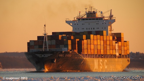
Vessel Msc Diego IMO: 9202649, MMSI: 357106000 Container Ship
UTC, -20.01412, 35.15538, course: 81, speed: 0
UTC, -20.01333, 35.15500, course: -1, speed: 0
2026-03-24 19:44:28 UTC, -20.01450, 35.15948, course: 272, speed: 0
Live Vessel Msc Diego Analytics (details, animations, etc.)
Live AIS position: UTC. 22 nm SE of Beira), updated 2026-03-24 19:44:28 UTC.Find the position of the vessel Msc Diego on the map. The latter are known coordinates and path.
marine traffic ship tracker show on live map
The current position of vessel Msc Diego is -20.01450 lat / 35.15948 lng. Updated: 2026-03-24 19:44:28 UTCDetails:
Last coordinates of the vessel:
UTC, -20.01167, 35.15500, course: -1, speed: 0UTC, -20.01412, 35.15538, course: 81, speed: 0
UTC, -20.01333, 35.15500, course: -1, speed: 0
2026-03-24 19:44:28 UTC, -20.01450, 35.15948, course: 272, speed: 0