 vesseltracker.com
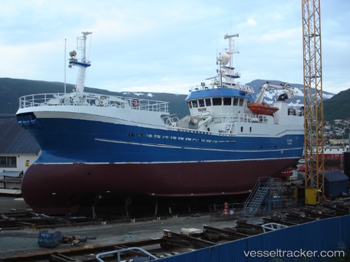
Vessel Kildin IMO: 9205196, MMSI: 259635000 Fish Carrier
UTC, 70.63659, 29.73516, course: 319, speed: 0.1
UTC, 70.63657, 29.73514, course: 318, speed: 0.1
2026-03-24 16:22:10 UTC, 70.63654, 29.73508, course: 319, speed: 0.1
Live Vessel Kildin Analytics (details, animations, etc.)
Live AIS position: UTC. Near BATSFJORD), updated 2026-03-24 16:22:10 UTC.Find the position of the vessel Kildin on the map. The latter are known coordinates and path.
marine traffic ship tracker show on live map
The current position of vessel Kildin is 70.63654 lat / 29.73508 lng. Updated: 2026-03-24 16:22:10 UTCCurrently sailing under the flag of Norway
Kildin built in 2001 year
Deadweight:
452 tDetails:
Last coordinates of the vessel:
UTC, 70.63655, 29.73521, course: 319, speed: 0UTC, 70.63659, 29.73516, course: 319, speed: 0.1
UTC, 70.63657, 29.73514, course: 318, speed: 0.1
2026-03-24 16:22:10 UTC, 70.63654, 29.73508, course: 319, speed: 0.1