 vesseltracker.com
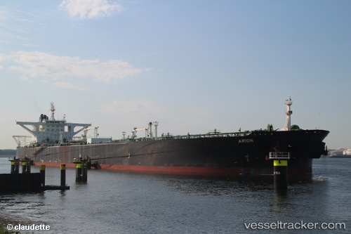
Vessel CENTURIES IMO: 9206310, MMSI: 373731000 Crude Oil Tanker
UTC, 28.57055, -94.32691, course: 336, speed: 0
UTC, 28.57044, -94.32785, course: 359, speed: 0
2026-02-08 06:14:45 UTC, 28.57054, -94.32859, course: 15, speed: 0
Live AIS position:
UTC. 50 nm SE of Sheppard),
updated 2026-02-08 06:14:45 UTC.
Find the position of the vessel CENTURIES on the map. The latter are known coordinates and path.
marine traffic ship tracker show on live map
The current position of vessel CENTURIES is 28.57054 lat / -94.32859 lng. Updated: 2026-02-08 06:14:45 UTCCurrently sailing under the flag of Panama
CENTURIES built in 2001 year
Deadweight:
309460 tDetails:
Last coordinates of the vessel:
UTC, 28.57091, -94.32627, course: 320, speed: 0UTC, 28.57055, -94.32691, course: 336, speed: 0
UTC, 28.57044, -94.32785, course: 359, speed: 0
2026-02-08 06:14:45 UTC, 28.57054, -94.32859, course: 15, speed: 0