 vesseltracker.com
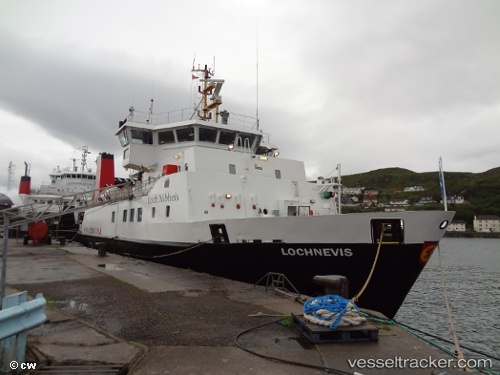
Vessel Lochnevis IMO: 9209063, MMSI: 235000141 Passenger Ro Ro Cargo Ship
UTC, 57.05557, -6.49079, course: 145, speed: 1
UTC, 57.00441, -6.06240, course: 91, speed: 11.8
2026-03-24 15:41:01 UTC, 57.06503, -5.89406, course: 59, speed: 0
Live Vessel Lochnevis Analytics (details, animations, etc.)
Live AIS position: UTC. Near Armadale, Isle of Skye), updated 2026-03-24 15:41:01 UTC.Find the position of the vessel Lochnevis on the map. The latter are known coordinates and path.
marine traffic ship tracker show on live map
The current position of vessel Lochnevis is 57.06503 lat / -5.89406 lng. Updated: 2026-03-24 15:41:01 UTCCurrently sailing under the flag of United Kingdom
Lochnevis built in 2000 year
Deadweight:
115 tDetails:
Last coordinates of the vessel:
UTC, 57.01110, -6.26491, course: 23, speed: 0UTC, 57.05557, -6.49079, course: 145, speed: 1
UTC, 57.00441, -6.06240, course: 91, speed: 11.8
2026-03-24 15:41:01 UTC, 57.06503, -5.89406, course: 59, speed: 0