 vesseltracker.com
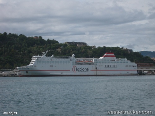
Ciudad A. Melilla
Current StatusLive Vessel Ciudad A. Melilla Analytics (details, animations, etc.)
Where is the vessel?
Ciudad A. Melilla is currently in 94 nm N of Caleta de Sebo, based on AIS data received about 2h ago.
Latest AIS update:
Current position: 30.79167° N, 13.70167° W (94 nm N of Caleta de Sebo)
Vessel profile: Ciudad A. Melilla is a Passenger Ro Ro Cargo Ship with dimensions 26m x 172m.
This page combines live AIS, route history, probable destination signals, nearby traffic, and port activity for practical vessel monitoring.
The current position of vessel Ciudad A. Melilla is 30.79167 lat / -13.70167 lng. Updated: 2026-03-25 05:17:27 UTCNearest reference points:
- 83 nm N of Caleta de Sebo
- 58 nm N of Caleta de Sebo
- 148 nm SE of Porto Santo Island
Details:
Last coordinates of the vessel:
2026-03-24 23:38:26 UTC, 29.29667, -15.20500, course: -1, speed: 202026-03-25 02:26:27 UTC, 30.05167, -14.48500, course: -1, speed: 21
2026-03-25 03:49:15 UTC, 30.41195, -14.10679, course: -1, speed: 21.3
2026-03-25 05:17:27 UTC, 30.79167, -13.70167, course: -1, speed: 20