 vesseltracker.com
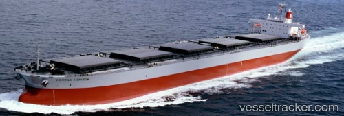
Vessel MANALAGI DASA IMO: 9217668, MMSI: 525101413 Bulk Carrier
UTC, -3.83008, 114.44142, course: -1, speed: 0
UTC, -3.82997, 114.44168, course: -1, speed: 0
2026-02-25 11:20:01 UTC, -3.82997, 114.44170, course: -1, speed: 0
Live AIS position:
UTC. Near Taboneo),
updated 2026-02-25 11:20:01 UTC.
Find the position of the vessel MANALAGI DASA on the map. The latter are known coordinates and path.
marine traffic ship tracker show on live map
The current position of vessel MANALAGI DASA is -3.82997 lat / 114.44170 lng. Updated: 2026-02-25 11:20:01 UTCCurrently sailing under the flag of Indonesia
MANALAGI DASA built in 2000 year
Deadweight:
88315 tDetails:
Last coordinates of the vessel:
UTC, -3.83008, 114.44132, course: 359, speed: 0UTC, -3.83008, 114.44142, course: -1, speed: 0
UTC, -3.82997, 114.44168, course: -1, speed: 0
2026-02-25 11:20:01 UTC, -3.82997, 114.44170, course: -1, speed: 0