 vesseltracker.com
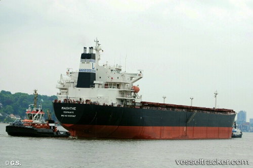
Vessel SM DONGHAE IMO: 9225067, MMSI: 441286000 Bulk Carrier
UTC, 34.86156, 127.74207, course: 271, speed: 0
UTC, 34.86156, 127.74211, course: 271, speed: 0.1
2026-03-24 15:32:37 UTC, 34.86154, 127.74215, course: 271, speed: 0.1
Live Vessel SM DONGHAE Analytics (details, animations, etc.)
Live AIS position: UTC. Near Sangam-dong), updated 2026-03-24 15:32:37 UTC.Find the position of the vessel SM DONGHAE on the map. The latter are known coordinates and path.
marine traffic ship tracker show on live map
The current position of vessel SM DONGHAE is 34.86154 lat / 127.74215 lng. Updated: 2026-03-24 15:32:37 UTCCurrently sailing under the flag of Korea (Republic of)
SM DONGHAE built in 2001 year
Deadweight:
76058 tDetails:
Last coordinates of the vessel:
UTC, 34.86160, 127.74216, course: 271, speed: 0UTC, 34.86156, 127.74207, course: 271, speed: 0
UTC, 34.86156, 127.74211, course: 271, speed: 0.1
2026-03-24 15:32:37 UTC, 34.86154, 127.74215, course: 271, speed: 0.1