 vesseltracker.com
 GSL NICOLETTA
Current Status
Where is the vessel?
GSL NICOLETTA is currently in 107 nm SE of HATTERAS, based on AIS data received about 1h ago.
Latest AIS update:
Current position: 33.71500° N, 74.51167° W (107 nm SE of HATTERAS)
Average speed (last 7 days): Loading…
Average speed (last 30 days): Loading…
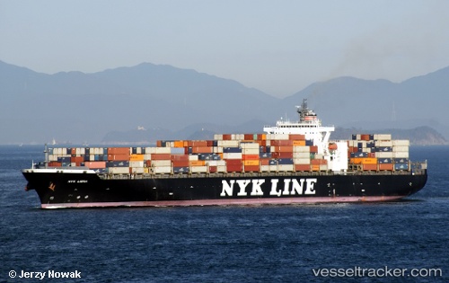
Vessel profile: GSL NICOLETTA is a Container Ship with dimensions 40m x 300m.
This page combines live AIS, route history, probable destination signals, nearby traffic, and port activity for practical vessel monitoring.
The current position of vessel GSL NICOLETTA is 33.71500 lat / -74.51167 lng. Updated: 2026-03-25 16:04:38 UTCNearest reference points:
- 91 nm E of Rodanthe
- Near HATTERAS
- 18 nm NE of Rodanthe
Currently sailing under the flag of Liberia ![]()
GSL NICOLETTA built in 2002 year
Deadweight:
78183 tDetails:
Live Vessel GSL NICOLETTA Analytics (details, animations, etc.)
Recent AIS points (UTC):
2026-03-25 09:52:37 UTC · 33.17333, -76.38667 · SOG 15 kn · COG -1°2026-03-25 11:13:38 UTC · 33.28500, -75.99166 · SOG 16 kn · COG -1°
2026-03-25 14:25:37 UTC · 33.56833, -75.02500 · SOG 16 kn · COG -1°
2026-03-25 16:04:38 UTC · 33.71500, -74.51167 · SOG 16 kn · COG -1°