 vesseltracker.com
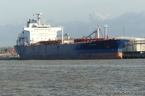
 Elka Bene
Current Status
Where is the vessel?
Elka Bene is currently in 145 nm E of Midway Island, based on AIS data received about 251d ago.
Latest AIS update:
Current position: 27.71951° N, 174.67351° W (145 nm E of Midway Island)
Average speed (last 7 days): Loading…
Average speed (last 30 days): Loading…
Vessel profile: Elka Bene is a Chemical Oil Products Tanker with dimensions 189m x 32m.
This page combines live AIS, route history, probable destination signals, nearby traffic, and port activity for practical vessel monitoring.
The current position of vessel Elka Bene is 27.71951 lat / -174.67351 lng. Updated: 2025-07-17 06:02:35 UTCNearest reference points:
- 115 nm N of Midway Island
Currently sailing under the flag of Liberia ![]()
Elka Bene built in 2002 year
Deadweight:
45467 tDetails:
Live Vessel Elka Bene Analytics (details, animations, etc.)
Recent AIS points (UTC):
2025-07-17 06:02:35 UTC · 27.71951, -174.67351 · SOG 26.1 kn · COG -1°