 vesseltracker.com
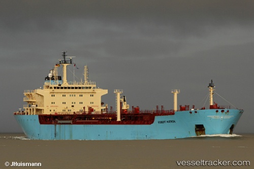
Vessel ROBERTA IMO: 9237008, MMSI: 636023554 Oil Products Tanker
UTC, 29.38631, 48.91372, course: -1, speed: 0.1
UTC, 29.38470, 48.91588, course: -1, speed: 0
2026-03-20 12:18:59 UTC, 29.38471, 48.91667, course: -1, speed: 0
Live Vessel ROBERTA Analytics (details, animations, etc.)
Live AIS position: UTC. 21 nm E of Rumaithiya), updated 2026-03-20 12:18:59 UTC.Find the position of the vessel ROBERTA on the map. The latter are known coordinates and path.
marine traffic ship tracker show on live map
The current position of vessel ROBERTA is 29.38471 lat / 48.91667 lng. Updated: 2026-03-20 12:18:59 UTCCurrently sailing under the flag of Liberia
Details:
Last coordinates of the vessel:
UTC, 29.38732, 48.91406, course: 120, speed: 0.1UTC, 29.38631, 48.91372, course: -1, speed: 0.1
UTC, 29.38470, 48.91588, course: -1, speed: 0
2026-03-20 12:18:59 UTC, 29.38471, 48.91667, course: -1, speed: 0