 vesseltracker.com
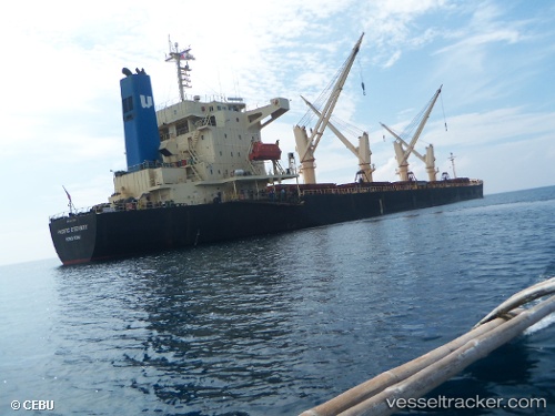
Vessel SANITA S IMO: 9237888, MMSI: 271049574 Bulk Carrier
UTC, 8.49190, -13.20614, course: 106, speed: 0
UTC, 8.49191, -13.20613, course: 106, speed: 0
2026-02-09 15:57:33 UTC, 8.49191, -13.20613, course: 106, speed: 0
Live AIS position:
UTC. Near Freetown),
updated 2026-02-09 15:57:33 UTC.
Find the position of the vessel SANITA S on the map. The latter are known coordinates and path.
marine traffic ship tracker show on live map
The current position of vessel SANITA S is 8.49191 lat / -13.20613 lng. Updated: 2026-02-09 15:57:33 UTCCurrently sailing under the flag of Turkey
SANITA S built in 2004 year
Deadweight:
46683 tDetails:
Last coordinates of the vessel:
UTC, 8.49189, -13.20618, course: 106, speed: 0UTC, 8.49190, -13.20614, course: 106, speed: 0
UTC, 8.49191, -13.20613, course: 106, speed: 0
2026-02-09 15:57:33 UTC, 8.49191, -13.20613, course: 106, speed: 0