 vesseltracker.com
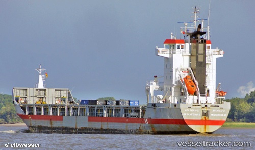
 ARCTICA 2
Current Status
Where is the vessel?
ARCTICA 2 is currently in 219 nm N of Matochkin Shar, based on AIS data received about 1h ago.
Latest AIS update:
Current position: 76.72279° N, 60.62504° E (219 nm N of Matochkin Shar)
Average speed (last 7 days): Loading…
Average speed (last 30 days): Loading…
Vessel profile: ARCTICA 2 is a Cargo/Containership with dimensions 135m x 17m.
This page combines live AIS, route history, probable destination signals, nearby traffic, and port activity for practical vessel monitoring.
The current position of vessel ARCTICA 2 is 76.72279 lat / 60.62504 lng. Updated: 2026-04-19 22:59:15 UTCCurrently sailing under the flag of Russia ![]()
ARCTICA 2 built in 2002 year
Deadweight:
9150 tDetails:
Live Vessel ARCTICA 2 Analytics (details, animations, etc.)
Recent AIS points (UTC):
2026-04-19 19:47:47 UTC · 76.78500, 61.59500 · SOG 4 kn · COG -1°2026-04-19 19:47:47 UTC · 76.78500, 61.59500 · SOG 4 kn · COG -1°
2026-04-19 21:49:13 UTC · 76.74204, 60.97203 · SOG 4.3 kn · COG 254°
2026-04-19 22:59:15 UTC · 76.72279, 60.62504 · SOG 4.4 kn · COG 253°