.
vessel 636021038 IMO: 9252424, vesseltracker.com
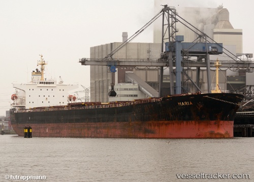
Vessel 636021038 IMO: 9252424, MMSI: 636021038

callsign:
size: x

Live AIS position: UTC. 19 nm SW of Exspan), updated 2026-01-15 11:01:30 UTC.

Find the position of the vessel 636021038 on the map. The latter are known coordinates and path.

marine traffic ship tracker show on live map

The current position of vessel 636021038 is -2.08040 lat / 104.99882 lng. Updated: 2026-01-15 11:01:30 UTC
Details:


Last coordinates of the vessel:
UTC, -2.08200, 104.99793, course: 329, speed: 0
UTC, -2.08225, 104.99735, course: 349, speed: 0
UTC, -2.08113, 104.99868, course: 295, speed: 0.1
2026-01-15 11:01:30 UTC, -2.08040, 104.99882, course: 285, speed: 0

Track of the vessel in the last 14 days


Most frequent ports a vessels calls at 636021038 (636021038):

Paradip, traffic: 5
Marmagao, traffic: 2
Port Elizabeth, traffic: 2
Mormugao, traffic: 2
La Coruna , traffic: 2
Singapore, traffic: 2
Kakinada, traffic: 2
Sao Luiz, traffic: 2
Algeciras, traffic: 1
Ra’S Shukhayr, traffic: 1
Aviles, traffic: 1
Sambu, traffic: 1
Bur Ibrahim, traffic: 1
Santos, traffic: 1
Galle, traffic: 1

Link to the map:


Find another ship

636021038 (636021038) last ports (portcalls and passsages)

Galle | 2024-01-04 19:23:14
Maputo | 2023-12-20 05:08:46
Paradip | 2022-12-24 20:45:23
Tuticorin | 2022-12-16 11:54:49
Paradip | 2022-12-09 02:52:21
Kakinada | 2022-12-06 20:28:00
Kakinada | 2022-12-02 17:50:55
Yen-Tai | 2022-11-14 02:03:56
Santos | 2022-07-04 16:23:18
La Coruna | 2022-06-06 13:07:11
La Coruna | 2022-06-02 13:04:36
Aviles | 2022-05-30 19:34:11
Algeciras | 2022-05-27 13:30:34
Bur Ibrahim | 2022-05-17 08:05:31
Ra’S Shukhayr | 2022-05-16 16:11:30
Lianyungang | 2022-04-03 12:31:08
Port Elizabeth | 2022-03-01 12:57:27
Sao Luiz | 2022-02-08 09:11:41
Mormugao | 2021-12-27 12:14:48
Paradip | 2021-12-19 22:07:54
Singapore | 2021-12-14 07:41:04