 vesseltracker.com
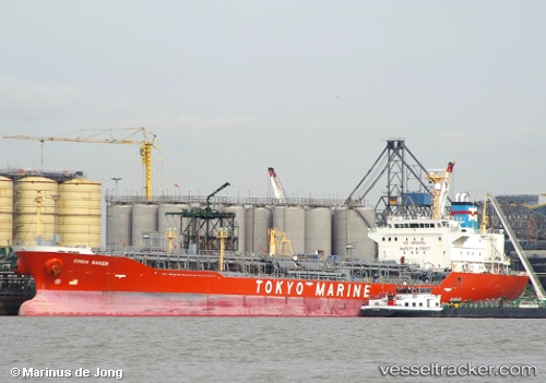
Vessel Ginga Saker IMO: 9258155, MMSI: 352530000 Chemical Oil Products Tanker
UTC, 17.45885, 116.00363, course: 208, speed: 11.4
UTC, 16.76102, 115.62235, course: 210, speed: 11.8
2026-03-24 00:00:29 UTC, 16.76102, 115.62235, course: 210, speed: 11.8
Live Vessel Ginga Saker Analytics (details, animations, etc.)
Live AIS position: UTC. 246 nm W of Bolinao), updated 2026-03-24 00:00:29 UTC.Find the position of the vessel Ginga Saker on the map. The latter are known coordinates and path.
marine traffic ship tracker show on live map
The current position of vessel Ginga Saker is 16.76102 lat / 115.62235 lng. Updated: 2026-03-24 00:00:29 UTCDetails:
Last coordinates of the vessel:
UTC, 17.45885, 116.00363, course: 208, speed: 11.4UTC, 17.45885, 116.00363, course: 208, speed: 11.4
UTC, 16.76102, 115.62235, course: 210, speed: 11.8
2026-03-24 00:00:29 UTC, 16.76102, 115.62235, course: 210, speed: 11.8