 vesseltracker.com
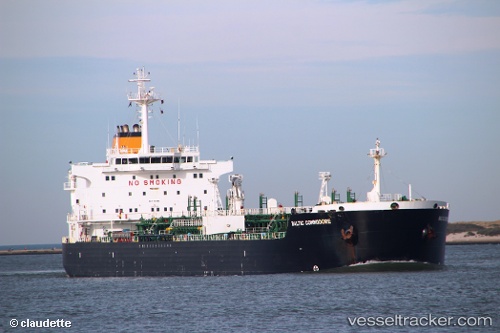
Vessel COMMODORE ONE IMO: 9260017, MMSI: 525121011 Chemical/Oil Products Tanker
UTC, -3.66481, 128.17426, course: 76, speed: 0
UTC, -3.66481, 128.17426, course: 76, speed: 0
2026-03-02 03:19:07 UTC, -3.66479, 128.17426, course: 76, speed: 0
Live AIS position:
UTC. Near WAYAME),
updated 2026-03-02 03:19:07 UTC.
Find the position of the vessel COMMODORE ONE on the map. The latter are known coordinates and path.
marine traffic ship tracker show on live map
The current position of vessel COMMODORE ONE is -3.66479 lat / 128.17426 lng. Updated: 2026-03-02 03:19:07 UTCCurrently sailing under the flag of Indonesia
COMMODORE ONE built in 2003 year
Deadweight:
37343 tDetails:
Last coordinates of the vessel:
UTC, -3.66484, 128.17416, course: 75, speed: 0UTC, -3.66481, 128.17426, course: 76, speed: 0
UTC, -3.66481, 128.17426, course: 76, speed: 0
2026-03-02 03:19:07 UTC, -3.66479, 128.17426, course: 76, speed: 0