 vesseltracker.com
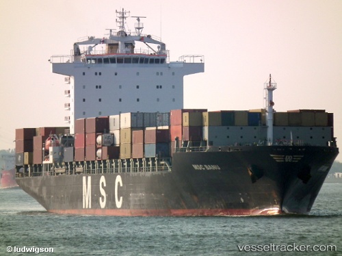
Vessel Msc Banu IMO: 9263332, MMSI: 372972000 Container Ship
UTC, 44.25787, 9.04959, course: 103, speed: 0.3
UTC, 44.27649, 9.04284, course: 39, speed: 0.8
2026-02-25 03:53:52 UTC, 44.25572, 9.02779, course: 83, speed: 0.7
Live AIS position:
UTC. Near Camogli),
updated 2026-02-25 03:53:52 UTC.
Find the position of the vessel Msc Banu on the map. The latter are known coordinates and path.
marine traffic ship tracker show on live map
The current position of vessel Msc Banu is 44.25572 lat / 9.02779 lng. Updated: 2026-02-25 03:53:52 UTCCurrently sailing under the flag of Panama
Msc Banu built in 2004 year
Deadweight:
42186 tDetails:
Last coordinates of the vessel:
UTC, 44.27076, 9.05716, course: 144, speed: 1UTC, 44.25787, 9.04959, course: 103, speed: 0.3
UTC, 44.27649, 9.04284, course: 39, speed: 0.8
2026-02-25 03:53:52 UTC, 44.25572, 9.02779, course: 83, speed: 0.7