 vesseltracker.com
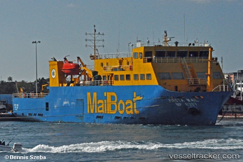
Vessel DONA TUTUTA IMO: 9266724, MMSI: 617117000 Passenger Ship
UTC, 16.88667, -24.99167, course: -1, speed: 0
UTC, 16.88667, -24.99167, course: -1, speed: 0
2026-02-13 23:19:41 UTC, 16.88667, -24.99167, course: -1, speed: 0
Live AIS position:
UTC. Near Mindelo),
updated 2026-02-13 23:19:41 UTC.
Find the position of the vessel DONA TUTUTA on the map. The latter are known coordinates and path.
marine traffic ship tracker show on live map
The current position of vessel DONA TUTUTA is 16.88667 lat / -24.99167 lng. Updated: 2026-02-13 23:19:41 UTCCurrently sailing under the flag of Cape Verde
DONA TUTUTA built in 2002 year
Deadweight:
679 tDetails:
Last coordinates of the vessel:
UTC, 16.88667, -24.99167, course: -1, speed: 0UTC, 16.88667, -24.99167, course: -1, speed: 0
UTC, 16.88667, -24.99167, course: -1, speed: 0
2026-02-13 23:19:41 UTC, 16.88667, -24.99167, course: -1, speed: 0