 vesseltracker.com
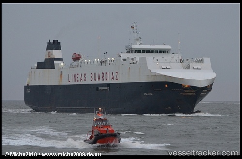
Vessel Galicia IMO: 9268409, MMSI: 255805895 Vehicles Carrier
Live Vessel Galicia Analytics (details, animations, etc.)
Live AIS position: UTC. 87 nm N of Villanueva de Lorenzana), updated 2026-02-23 07:42:35 UTC.Find the position of the vessel Galicia on the map. The latter are known coordinates and path.
marine traffic ship tracker show on live map
The current position of vessel Galicia is 44.82074 lat / -10.02480 lng. Updated: 2026-02-23 07:42:35 UTCCurrently sailing under the flag of Portugal
Galicia built in 2003 year
Deadweight:
4400 tDetails:
Last coordinates of the vessel:
2026-02-23 07:42:35 UTC, 44.82074, -10.02480, course: 33, speed: 13.4