 vesseltracker.com
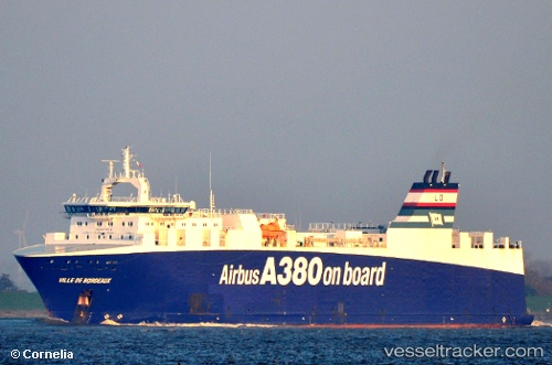
Vessel Ville De Bordeaux IMO: 9270842, MMSI: 228084000 Ro Ro Cargo Ship
2026-03-25 00:19:29 UTC, 26.51850, -78.79538, course: 24, speed: 0
2026-03-25 01:47:50 UTC, 26.51854, -78.79547, course: 117, speed: 0.3
2026-03-25 04:14:57 UTC, 26.34166, -78.52500, course: -1, speed: 19
Live Vessel Ville De Bordeaux Analytics (details, animations, etc.)
Live AIS position: UTC. 12 nm SE of Lucaya), updated 2026-03-25 04:14:57 UTC.Find the position of the vessel Ville De Bordeaux on the map. The latter are known coordinates and path.
marine traffic ship tracker show on live map
The current position of vessel Ville De Bordeaux is 26.34166 lat / -78.52500 lng. Updated: 2026-03-25 04:14:57 UTCNearest reference points:
- 44 nm S of Freeport
- 44 nm E of Surfside
- Near Green Turtle Cay
Currently sailing under the flag of France
Ville De Bordeaux built in 2004 year
Deadweight:
5200 tDetails:
Last coordinates of the vessel:
2026-03-24 21:22:28 UTC, 26.51859, -78.79460, course: 298, speed: 0.12026-03-25 00:19:29 UTC, 26.51850, -78.79538, course: 24, speed: 0
2026-03-25 01:47:50 UTC, 26.51854, -78.79547, course: 117, speed: 0.3
2026-03-25 04:14:57 UTC, 26.34166, -78.52500, course: -1, speed: 19