 vesseltracker.com
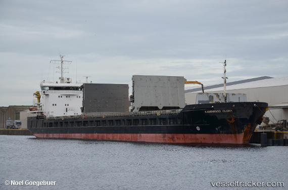
 Karewood Glory
Current Status
Where is the vessel?
Karewood Glory is currently in 11 nm NE of Withernsea, based on AIS data received about 2h ago.
Latest AIS update:
Current position: 53.89191° N, 0.49046° E (11 nm NE of Withernsea)
Average speed (last 7 days): Loading…
Average speed (last 30 days): Loading…
Vessel profile: Karewood Glory is a General Cargo Ship with dimensions 127m x 127m.
This page combines live AIS, route history, probable destination signals, nearby traffic, and port activity for practical vessel monitoring.
The current position of vessel Karewood Glory is 53.89191 lat / 0.49046 lng. Updated: 2026-03-26 01:37:30 UTCNearest reference points:
- Near Withernsea
- 14 nm E of Withernsea
- Near Flamborough
Currently sailing under the flag of Bahamas ![]()
Karewood Glory built in 2006 year
Deadweight:
6315 tDetails:
Live Vessel Karewood Glory Analytics (details, animations, etc.)
Recent AIS points (UTC):
2026-03-25 20:16:56 UTC · 54.40318, -0.21860 · SOG 7.9 kn · COG 135°2026-03-25 21:24:49 UTC · 54.28583, -0.05190 · SOG 7.8 kn · COG 137°
2026-03-25 23:43:24 UTC · 54.05763, 0.25948 · SOG 7.2 kn · COG 137°
2026-03-26 01:37:30 UTC · 53.89191, 0.49046 · SOG 6.1 kn · COG 136°