 vesseltracker.com
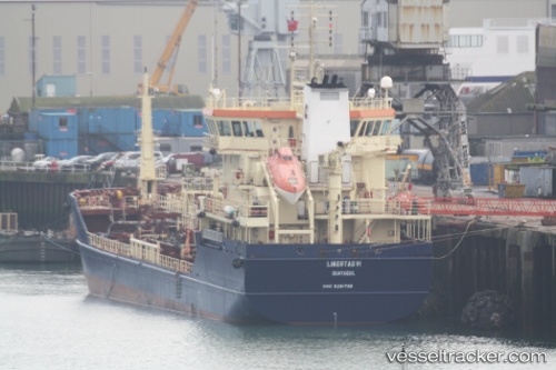
Vessel Libertad 6 IMO: 9281798, MMSI: 735058815 Oil Products Tanker
UTC, -2.25295, -79.91069, course: 315, speed: 0
UTC, -2.25292, -79.91067, course: 316, speed: 0
2026-02-10 01:25:46 UTC, -2.25297, -79.91066, course: 316, speed: 0
Live AIS position:
UTC. Near Puerto Nuevo),
updated 2026-02-10 01:25:46 UTC.
Find the position of the vessel Libertad 6 on the map. The latter are known coordinates and path.
marine traffic ship tracker show on live map
The current position of vessel Libertad 6 is -2.25297 lat / -79.91066 lng. Updated: 2026-02-10 01:25:46 UTCDetails:
Last coordinates of the vessel:
UTC, -2.25291, -79.91067, course: 315, speed: 0UTC, -2.25295, -79.91069, course: 315, speed: 0
UTC, -2.25292, -79.91067, course: 316, speed: 0
2026-02-10 01:25:46 UTC, -2.25297, -79.91066, course: 316, speed: 0