 vesseltracker.com
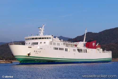
Vessel Oita IMO: 9282560, MMSI: 431501774 Passenger Ro Ro Cargo Ship
UTC, 33.23745, 132.01411, course: 237, speed: 19.4
UTC, 33.26285, 132.05862, course: 52, speed: 20.1
2026-02-18 18:04:52 UTC, 33.44880, 132.39133, course: 41, speed: 0.1
Live AIS position:
UTC. Near IKATA),
updated 2026-02-18 18:04:52 UTC.
Find the position of the vessel Oita on the map. The latter are known coordinates and path.
marine traffic ship tracker show on live map
The current position of vessel Oita is 33.44880 lat / 132.39133 lng. Updated: 2026-02-18 18:04:52 UTCDetails:
Last coordinates of the vessel:
UTC, 33.45813, 132.41479, course: 59, speed: 0UTC, 33.23745, 132.01411, course: 237, speed: 19.4
UTC, 33.26285, 132.05862, course: 52, speed: 20.1
2026-02-18 18:04:52 UTC, 33.44880, 132.39133, course: 41, speed: 0.1