 vesseltracker.com
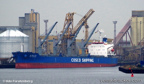
Vessel New Liulinhai IMO: 9285108, MMSI: 351700000 Bulk Carrier
UTC, 0.99371, -154.28571, course: 270, speed: 12.8
UTC, 0.99336, -154.45576, course: 268, speed: 12.6
2026-01-19 13:52:30 UTC, 0.99082, -154.80211, course: 269, speed: 11.8
Live AIS position:
UTC. 170 nm E of Christmas Island),
updated 2026-01-19 13:52:30 UTC.
Find the position of the vessel New Liulinhai on the map. The latter are known coordinates and path.
marine traffic ship tracker show on live map
The current position of vessel New Liulinhai is 0.99082 lat / -154.80211 lng. Updated: 2026-01-19 13:52:30 UTCDetails:
Last coordinates of the vessel:
UTC, 0.99304, -153.98952, course: 269, speed: 12.6UTC, 0.99371, -154.28571, course: 270, speed: 12.8
UTC, 0.99336, -154.45576, course: 268, speed: 12.6
2026-01-19 13:52:30 UTC, 0.99082, -154.80211, course: 269, speed: 11.8