 vesseltracker.com
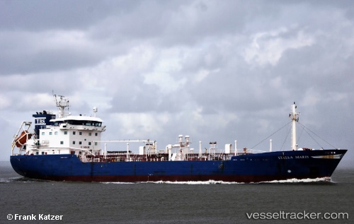
Vessel Stella Maris IMO: 9297101, MMSI: 246315000 Asphalt Bitumen Tanker
Live AIS position:
UTC. Near Aliaga),
updated 2024-10-26 10:01:27 UTC.
Find the position of the vessel Stella Maris on the map. The latter are known coordinates and path.
marine traffic ship tracker show on live map
The current position of vessel Stella Maris is 38.88420 lat / 26.93568 lng. Updated: 2024-10-26 10:01:27 UTCCurrently sailing under the flag of Netherlands
Stella Maris built in 2004 year
Deadweight:
4531 tDetails:
Last coordinates of the vessel:
2024-10-26 10:01:27 UTC, 38.88420, 26.93568, course: 35, speed: 0