 vesseltracker.com
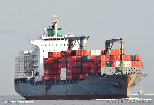
Vessel Margarete Schulte IMO: 9302944, MMSI: 249837000 Container Ship
UTC, 9.36689, -79.88403, course: 247, speed: 0
UTC, 9.36692, -79.88437, course: 247, speed: 0
2026-03-24 16:04:47 UTC, 9.36699, -79.88396, course: 247, speed: 0
Live Vessel Margarete Schulte Analytics (details, animations, etc.)
Live AIS position: UTC. Near COLON 2000), updated 2026-03-24 16:04:47 UTC.Find the position of the vessel Margarete Schulte on the map. The latter are known coordinates and path.
marine traffic ship tracker show on live map
The current position of vessel Margarete Schulte is 9.36699 lat / -79.88396 lng. Updated: 2026-03-24 16:04:47 UTCDetails:
Last coordinates of the vessel:
UTC, 9.36685, -79.88425, course: 247, speed: 0UTC, 9.36689, -79.88403, course: 247, speed: 0
UTC, 9.36692, -79.88437, course: 247, speed: 0
2026-03-24 16:04:47 UTC, 9.36699, -79.88396, course: 247, speed: 0