 vesseltracker.com
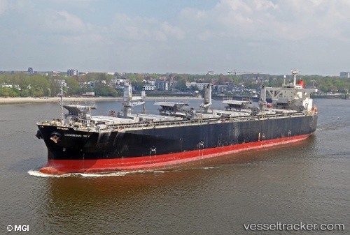
Luminous Sky
Current StatusWhere is the vessel?
Luminous Sky is currently in Near DUNG QUAT, based on AIS data received about 2h ago.
Latest AIS update:
Current position: 15.41532° N, 108.79555° E (Near DUNG QUAT)
Average speed (last 7 days): Loading…
Average speed (last 30 days): Loading…
Vessel profile: Luminous Sky is a Wood Chips Carrier with dimensions 37m x 203m.
This page combines live AIS, route history, probable destination signals, nearby traffic, and port activity for practical vessel monitoring.
The current position of vessel Luminous Sky is 15.41532 lat / 108.79555 lng. Updated: 2026-03-25 17:24:34 UTCNearest reference points:
- Near DUNG QUAT
- Near Thuan An
- 23 nm E of Hai Son
Details:
Live Vessel Luminous Sky Analytics (details, animations, etc.)
Recent AIS points (UTC):
2026-03-25 12:18:35 UTC · 15.41532, 108.79560 · SOG 0 kn · COG 130°2026-03-25 14:00:33 UTC · 15.41530, 108.79557 · SOG 0 kn · COG 129°
2026-03-25 15:39:33 UTC · 15.41530, 108.79558 · SOG 0 kn · COG 129°
2026-03-25 17:24:34 UTC · 15.41532, 108.79555 · SOG 0 kn · COG 129°