 vesseltracker.com
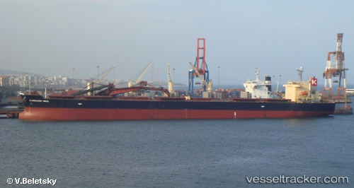
Vessel Omicron Titina IMO: 9304277, MMSI: 636018628 Bulk Carrier
UTC, 44.94808, -8.87690, course: 214, speed: 11.4
UTC, 44.62508, -9.12433, course: 211, speed: 11.7
2026-02-21 13:23:56 UTC, 44.25828, -9.39338, course: 213, speed: 11.6
Live AIS position:
UTC. 48 nm N of Villanueva de Lorenzana),
updated 2026-02-21 13:23:56 UTC.
Find the position of the vessel Omicron Titina on the map. The latter are known coordinates and path.
marine traffic ship tracker show on live map
The current position of vessel Omicron Titina is 44.25828 lat / -9.39338 lng. Updated: 2026-02-21 13:23:56 UTCDetails:
Last coordinates of the vessel:
UTC, 45.17527, -8.70935, course: 208, speed: 10.7UTC, 44.94808, -8.87690, course: 214, speed: 11.4
UTC, 44.62508, -9.12433, course: 211, speed: 11.7
2026-02-21 13:23:56 UTC, 44.25828, -9.39338, course: 213, speed: 11.6