 vesseltracker.com
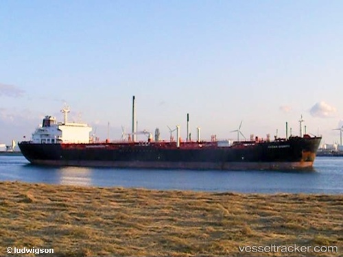
Vessel BIANCA IMO: 9306641, MMSI: 305986000 Chemical/Oil Products Tanker
UTC, 13.76500, -60.24500, course: -1, speed: 1
UTC, 13.85333, -60.25167, course: -1, speed: 1
2026-02-25 14:08:54 UTC, 13.89833, -60.25500, course: -1, speed: 1
Live AIS position:
UTC. 41 nm E of Saint Lucia Apt),
updated 2026-02-25 14:08:54 UTC.
Find the position of the vessel BIANCA on the map. The latter are known coordinates and path.
marine traffic ship tracker show on live map
The current position of vessel BIANCA is 13.89833 lat / -60.25500 lng. Updated: 2026-02-25 14:08:54 UTCCurrently sailing under the flag of Antigua Barbuda
BIANCA built in 2006 year
Deadweight:
34663 tDetails:
Last coordinates of the vessel:
UTC, 13.73667, -60.24333, course: -1, speed: 1UTC, 13.76500, -60.24500, course: -1, speed: 1
UTC, 13.85333, -60.25167, course: -1, speed: 1
2026-02-25 14:08:54 UTC, 13.89833, -60.25500, course: -1, speed: 1