 vesseltracker.com
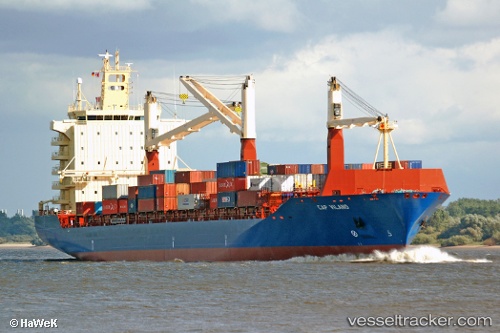
Vessel HUTTON IMO: 9311787, MMSI: 636022635 Container Ship
UTC, 18.43290, -66.09943, course: 238, speed: 0
UTC, 18.43292, -66.09945, course: 238, speed: 0
2026-02-26 12:31:09 UTC, 18.43292, -66.09943, course: 237, speed: 0
Live AIS position:
UTC. Near Puerta de Tierra),
updated 2026-02-26 12:31:09 UTC.
Find the position of the vessel HUTTON on the map. The latter are known coordinates and path.
marine traffic ship tracker show on live map
The current position of vessel HUTTON is 18.43292 lat / -66.09943 lng. Updated: 2026-02-26 12:31:09 UTCCurrently sailing under the flag of Liberia
Details:
Last coordinates of the vessel:
UTC, 18.43293, -66.09942, course: 238, speed: 0UTC, 18.43290, -66.09943, course: 238, speed: 0
UTC, 18.43292, -66.09945, course: 238, speed: 0
2026-02-26 12:31:09 UTC, 18.43292, -66.09943, course: 237, speed: 0