 vesseltracker.com
 CAN KA
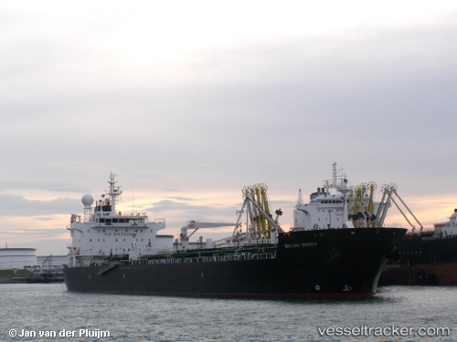
Current Status
Where is the vessel?
CAN KA is currently in Near Maltepe, based on AIS data received about 2h ago.
Latest AIS update:
Current position: 40.77932° N, 29.02602° E (Near Maltepe)
Average speed (last 7 days): Loading…
Average speed (last 30 days): Loading…
Vessel profile: CAN KA is a Chemical/Oil Products Tanker with dimensions 28m x 184m.
This page combines live AIS, route history, probable destination signals, nearby traffic, and port activity for practical vessel monitoring.
The current position of vessel CAN KA is 40.77932 lat / 29.02602 lng. Updated: 2026-03-25 23:31:20 UTCNearest reference points:
- Near Maltepe
- 11 nm S of Maltepe
- 14 nm SW of Maltepe
Currently sailing under the flag of Turkey ![]()
CAN KA built in 2006 year
Deadweight:
37582 tDetails:
Live Vessel CAN KA Analytics (details, animations, etc.)
Recent AIS points (UTC):
2026-03-25 18:23:48 UTC · 40.75984, 29.04065 · SOG 0.2 kn · COG 125°2026-03-25 19:50:29 UTC · 40.76341, 29.03017 · SOG 0.4 kn · COG 137°
2026-03-25 21:42:30 UTC · 40.77005, 29.02299 · SOG 0.2 kn · COG 100°
2026-03-25 23:31:20 UTC · 40.77932, 29.02602 · SOG 0.4 kn · COG 121°