.
vessel STAR ENERGY IMO: 9314090, Bulk Carrier vesseltracker.com
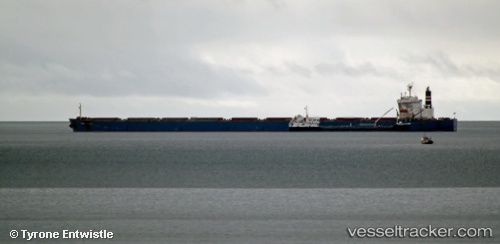
Vessel STAR ENERGY IMO: 9314090, MMSI: 538009581 Bulk Carrier

callsign: V7A4917
size: 45x289

Live AIS position: UTC. Open sea (no nearby ports in database)), updated 2026-02-04 02:23:37 UTC.

Find the position of the vessel STAR ENERGY on the map. The latter are known coordinates and path.

marine traffic ship tracker show on live map

The current position of vessel STAR ENERGY is -55.90428 lat / -131.19810 lng. Updated: 2026-02-04 02:23:37 UTC

Currently sailing under the flag of Marshall Islands

STAR ENERGY built in 2004 year

Deadweight:
180310 t

Details:


Last coordinates of the vessel:
2026-02-04 02:23:37 UTC, -55.90428, -131.19810, course: -1, speed: 0

Track of the vessel in the last 28 days


Most frequent ports a vessels calls at STAR ENERGY (538009581):

Iskenderun, traffic: 5
Port Said, traffic: 3
Sambu, traffic: 3
Bur Ibrahim, traffic: 3
Dalian, traffic: 3
Dalien, traffic: 3
Singapore, traffic: 2
Luanda, traffic: 1
Ras Gharib, traffic: 1
Algeciras, traffic: 1
Ayn Sukhnah, traffic: 1
Canakkale, traffic: 1
Gelibolu, traffic: 1

Link to the map:


Find another ship

STAR_ENERGY (538009581) last ports (portcalls and passsages)

Iskenderun | 2024-03-12 20:47:16
Iskenderun | 2024-03-08 20:35:03
Iskenderun | 2024-03-04 18:59:21
Iskenderun | 2024-02-29 17:46:29
Iskenderun | 2024-02-23 20:04:10
Port Said | 2024-02-22 15:20:04
Bur Ibrahim | 2024-02-22 05:36:14
Singapore | 2024-02-05 23:55:08
Dalien | 2024-01-23 04:50:48
Dalien | 2024-01-15 09:03:30
Dalien | 2024-01-11 08:33:32
Luanda | 2023-11-06 03:25:03
Algeciras | 2023-06-22 15:49:48
Port Said | 2023-06-03 15:04:50
Bur Ibrahim | 2023-06-03 04:59:05
Singapore | 2023-05-08 14:33:57
Sambu | 2023-02-02 09:04:24
Ras Gharib | 2023-01-15 03:07:02
Ayn Sukhnah | 2023-01-14 20:22:50
Bur Ibrahim | 2023-01-14 17:52:10
Port Said | 2023-01-14 05:55:00
Canakkale | 2023-01-11 11:17:40
Gelibolu | 2023-01-11 09:03:36