 vesseltracker.com
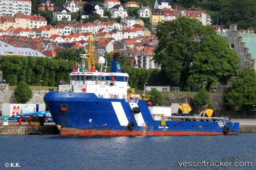
Vessel OCEANIC FRONTIER IMO: 9318838, MMSI: 657992150 Offshore Supply Ship
UTC, 6.39500, 3.89667, course: -1, speed: 0
UTC, 6.39500, 3.89833, course: -1, speed: 0
2026-03-24 08:02:37 UTC, 6.39561, 3.89825, course: 215, speed: 0.8
Live Vessel OCEANIC FRONTIER Analytics (details, animations, etc.)
Live AIS position: UTC. 14 nm S of Ketu), updated 2026-03-24 08:02:37 UTC.Find the position of the vessel OCEANIC FRONTIER on the map. The latter are known coordinates and path.
marine traffic ship tracker show on live map
The current position of vessel OCEANIC FRONTIER is 6.39561 lat / 3.89825 lng. Updated: 2026-03-24 08:02:37 UTCCurrently sailing under the flag of Nigeria
Details:
Last coordinates of the vessel:
UTC, 6.39561, 3.89830, course: -1, speed: 0.5UTC, 6.39500, 3.89667, course: -1, speed: 0
UTC, 6.39500, 3.89833, course: -1, speed: 0
2026-03-24 08:02:37 UTC, 6.39561, 3.89825, course: 215, speed: 0.8