 vesseltracker.com
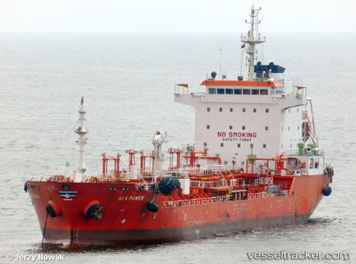
Vessel Sea Power IMO: 9322126, MMSI: 538002814 Chemical Oil Products Tanker
UTC, 7.42667, -17.41500, course: -1, speed: 2
UTC, 7.34167, -17.38167, course: -1, speed: 2
2026-03-24 15:37:40 UTC, 7.28167, -17.35333, course: -1, speed: 2
Live Vessel Sea Power Analytics (details, animations, etc.)
Live AIS position: UTC. 249 nm SW of Port de Boké), updated 2026-03-24 15:37:40 UTC.Find the position of the vessel Sea Power on the map. The latter are known coordinates and path.
marine traffic ship tracker show on live map
The current position of vessel Sea Power is 7.28167 lat / -17.35333 lng. Updated: 2026-03-24 15:37:40 UTCDetails:
Last coordinates of the vessel:
UTC, 7.47157, -17.44757, course: 149, speed: 2.5UTC, 7.42667, -17.41500, course: -1, speed: 2
UTC, 7.34167, -17.38167, course: -1, speed: 2
2026-03-24 15:37:40 UTC, 7.28167, -17.35333, course: -1, speed: 2