 vesseltracker.com
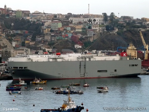
Vessel Sierra Nevada Hwy IMO: 9325439, MMSI: 372346000 Vehicles Carrier
UTC, 39.91790, -146.45013, course: 90, speed: 16.9
UTC, 39.88826, -145.32318, course: 92, speed: 17.4
2026-02-17 08:02:06 UTC, 39.87670, -144.72902, course: 89, speed: 17.3
Live AIS position:
UTC. 344 nm NW of Fukagawa),
updated 2026-02-17 08:02:06 UTC.
Find the position of the vessel Sierra Nevada Hwy on the map. The latter are known coordinates and path.
marine traffic ship tracker show on live map
The current position of vessel Sierra Nevada Hwy is 39.87670 lat / -144.72902 lng. Updated: 2026-02-17 08:02:06 UTCDetails:
Last coordinates of the vessel:
UTC, 39.94206, -147.15030, course: 91, speed: 17.5UTC, 39.91790, -146.45013, course: 90, speed: 16.9
UTC, 39.88826, -145.32318, course: 92, speed: 17.4
2026-02-17 08:02:06 UTC, 39.87670, -144.72902, course: 89, speed: 17.3