 vesseltracker.com
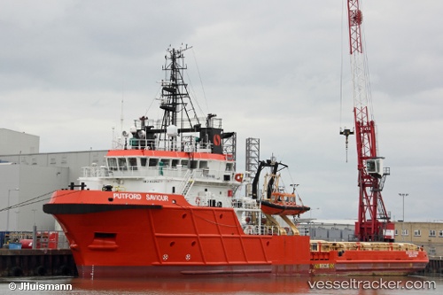
Vessel PUTFORD SAVIOUR IMO: 9329277, MMSI: 232035072 Offshore Supply Ship
UTC, 53.80354, 1.03704, course: -1, speed: 0.5
UTC, 53.80354, 1.03704, course: -1, speed: 0.5
2026-03-24 15:44:17 UTC, 53.74639, 1.05307, course: 188, speed: 2.2
Live Vessel PUTFORD SAVIOUR Analytics (details, animations, etc.)
Live AIS position: UTC. 26 nm E of Withernsea), updated 2026-03-24 15:44:17 UTC.Find the position of the vessel PUTFORD SAVIOUR on the map. The latter are known coordinates and path.
marine traffic ship tracker show on live map
The current position of vessel PUTFORD SAVIOUR is 53.74639 lat / 1.05307 lng. Updated: 2026-03-24 15:44:17 UTCCurrently sailing under the flag of United Kingdom
PUTFORD SAVIOUR built in 2004 year
Deadweight:
1828 tDetails:
Last coordinates of the vessel:
UTC, 53.80354, 1.03704, course: -1, speed: 0.5UTC, 53.80354, 1.03704, course: -1, speed: 0.5
UTC, 53.80354, 1.03704, course: -1, speed: 0.5
2026-03-24 15:44:17 UTC, 53.74639, 1.05307, course: 188, speed: 2.2