 vesseltracker.com
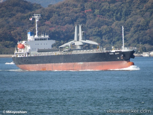
Vessel Toyo Hope IMO: 9330147, MMSI: 371279000 General Cargo Ship
UTC, 10.02250, 120.82073, course: 343, speed: 10.5
UTC, 10.02250, 120.82073, course: 343, speed: 10.5
2026-03-24 17:04:25 UTC, 10.02250, 120.82073, course: 343, speed: 10.5
Live Vessel Toyo Hope Analytics (details, animations, etc.)
Live AIS position: UTC. 79 nm SW of Hamtic), updated 2026-03-24 17:04:25 UTC.Find the position of the vessel Toyo Hope on the map. The latter are known coordinates and path.
marine traffic ship tracker show on live map
The current position of vessel Toyo Hope is 10.02250 lat / 120.82073 lng. Updated: 2026-03-24 17:04:25 UTCCurrently sailing under the flag of Panama
Details:
Last coordinates of the vessel:
UTC, 9.74925, 120.91082, course: -1, speed: 10.8UTC, 10.02250, 120.82073, course: 343, speed: 10.5
UTC, 10.02250, 120.82073, course: 343, speed: 10.5
2026-03-24 17:04:25 UTC, 10.02250, 120.82073, course: 343, speed: 10.5