 vesseltracker.com
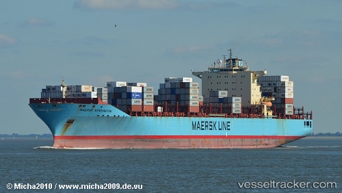
Vessel Maersk Kensington IMO: 9333010, MMSI: 303657000 Container Ship
UTC, 24.59333, -83.68667, course: -1, speed: 15
UTC, 24.72667, -84.03833, course: -1, speed: 16
2026-03-25 00:17:38 UTC, 25.01167, -84.82833, course: -1, speed: 17
Live Vessel Maersk Kensington Analytics (details, animations, etc.)
Live AIS position: UTC. 106 nm W of Florida Straits), updated 2026-03-25 00:17:38 UTC.Find the position of the vessel Maersk Kensington on the map. The latter are known coordinates and path.
marine traffic ship tracker show on live map
The current position of vessel Maersk Kensington is 25.01167 lat / -84.82833 lng. Updated: 2026-03-25 00:17:38 UTCDetails:
Last coordinates of the vessel:
UTC, 24.38167, -83.09833, course: -1, speed: 16UTC, 24.59333, -83.68667, course: -1, speed: 15
UTC, 24.72667, -84.03833, course: -1, speed: 16
2026-03-25 00:17:38 UTC, 25.01167, -84.82833, course: -1, speed: 17