 vesseltracker.com
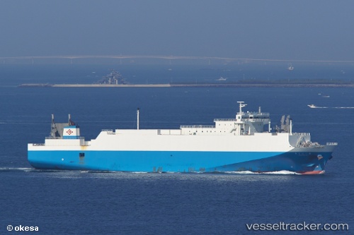
Vessel Harumaru No1 IMO: 9333747, MMSI: 431501868 Ro Ro Cargo Ship
UTC, 31.16014, 130.66605, course: 198, speed: 21.3
UTC, 30.81858, 130.50024, course: 207, speed: 21.3
2026-03-24 11:22:44 UTC, 30.18667, 130.24834, course: -1, speed: 19
Live Vessel Harumaru No1 Analytics (details, animations, etc.)
Live AIS position: UTC. 50 nm SW of NISHINOOMOTE), updated 2026-03-24 11:22:44 UTC.Find the position of the vessel Harumaru No1 on the map. The latter are known coordinates and path.
marine traffic ship tracker show on live map
The current position of vessel Harumaru No1 is 30.18667 lat / 130.24834 lng. Updated: 2026-03-24 11:22:44 UTCCurrently sailing under the flag of Japan
Harumaru No1 built in 2006 year
Deadweight:
4299 tDetails:
Last coordinates of the vessel:
UTC, 31.48835, 130.51855, course: 300, speed: 0UTC, 31.16014, 130.66605, course: 198, speed: 21.3
UTC, 30.81858, 130.50024, course: 207, speed: 21.3
2026-03-24 11:22:44 UTC, 30.18667, 130.24834, course: -1, speed: 19