 vesseltracker.com
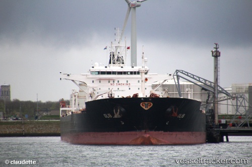
Vessel Olib IMO: 9334739, MMSI: 238252000 Crude Oil Tanker
UTC, 54.79269, 10.82711, course: 23, speed: 11.2
UTC, 55.09845, 10.99296, course: 1, speed: 11.4
2026-02-17 23:42:46 UTC, 55.32723, 11.03841, course: 0, speed: 10.2
Live AIS position:
UTC. Near Korsor),
updated 2026-02-17 23:42:46 UTC.
Find the position of the vessel Olib on the map. The latter are known coordinates and path.
marine traffic ship tracker show on live map
The current position of vessel Olib is 55.32723 lat / 11.03841 lng. Updated: 2026-02-17 23:42:46 UTCCurrently sailing under the flag of Croatia
Olib built in 2009 year
Deadweight:
108433 tDetails:
Last coordinates of the vessel:
UTC, 54.60126, 11.15254, course: 275, speed: 11.5UTC, 54.79269, 10.82711, course: 23, speed: 11.2
UTC, 55.09845, 10.99296, course: 1, speed: 11.4
2026-02-17 23:42:46 UTC, 55.32723, 11.03841, course: 0, speed: 10.2