 vesseltracker.com
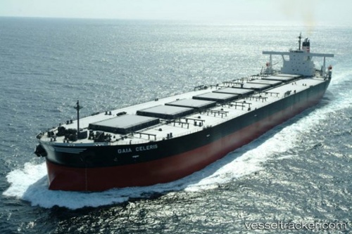
Vessel BERGE CAUBVICK IMO: 9335848, MMSI: 636020520 Ore Carrier
UTC, -34.35482, 34.98396, course: 92, speed: 11.9
UTC, -34.33189, 35.52670, course: 89, speed: 12.5
2026-03-24 17:21:16 UTC, -34.31555, 35.79020, course: 85, speed: 12.1
Live Vessel BERGE CAUBVICK Analytics (details, animations, etc.)
Live AIS position: UTC. 343 nm SE of Port Edward), updated 2026-03-24 17:21:16 UTC.Find the position of the vessel BERGE CAUBVICK on the map. The latter are known coordinates and path.
marine traffic ship tracker show on live map
The current position of vessel BERGE CAUBVICK is -34.31555 lat / 35.79020 lng. Updated: 2026-03-24 17:21:16 UTCCurrently sailing under the flag of Liberia
BERGE CAUBVICK built in 2006 year
Deadweight:
229045 tDetails:
Last coordinates of the vessel:
UTC, -34.40245, 34.42340, course: 90, speed: 11.6UTC, -34.35482, 34.98396, course: 92, speed: 11.9
UTC, -34.33189, 35.52670, course: 89, speed: 12.5
2026-03-24 17:21:16 UTC, -34.31555, 35.79020, course: 85, speed: 12.1