.
vessel Freedom IMO: 9336414, Crude Oil Tanker vesseltracker.com
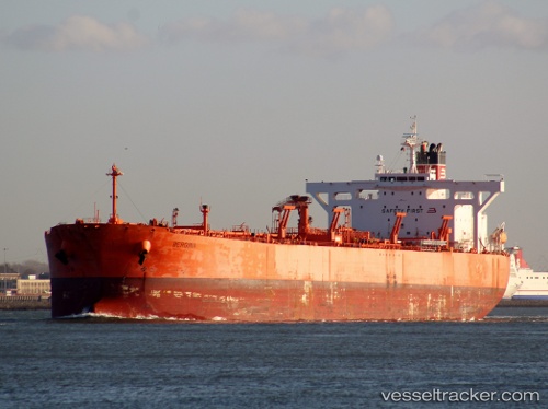
Vessel Freedom IMO: 9336414, MMSI: 574004970 Crude Oil Tanker

callsign: XVIG7
size: 240x42

Live AIS position: UTC. Near Nghi Son), updated 2025-05-18 00:29:27 UTC.

Find the position of the vessel Freedom on the map. The latter are known coordinates and path.

marine traffic ship tracker show on live map

The current position of vessel Freedom is 19.28528 lat / 105.83701 lng. Updated: 2025-05-18 00:29:27 UTC

Currently sailing under the flag of Vietnam

Details:


Last coordinates of the vessel:
2025-05-18 00:29:27 UTC, 19.28528, 105.83701, course: -1, speed: 0.6

Track of the vessel in the last 14 days


Most frequent ports a vessels calls at Freedom (574004970):

Uskudar, traffic: 2
Nghi Son, traffic: 2
Land Skrona, traffic: 2
Bur Ibrahim, traffic: 2
Port Said, traffic: 2
Ras Gharib, traffic: 2
Helsingborg, traffic: 1
Vung Tau, traffic: 1
Helsingor, traffic: 1
Istanbul, traffic: 1
Jiddah, traffic: 1
Korsor, traffic: 1
Canakkale, traffic: 1
Primorsk, traffic: 1
Cape St. Jacques, traffic: 1

Link to the map:


Find another ship

Freedom (574004970) last ports (portcalls and passsages)

Nghi Son | 2025-05-18 00:48:02
Nghi Son | 2025-04-19 04:26:00
Vung Tau | 2022-12-26 17:51:41
Jiddah | 2022-10-27 07:03:21
Ras Gharib | 2022-10-25 01:31:04
Uskudar | 2022-10-12 07:19:13
Uskudar | 2022-09-26 13:05:01
Gelibolu | 2022-09-24 13:29:47
Canakkale | 2022-09-24 10:26:12
Port Said | 2022-09-06 19:03:51
Bur Ibrahim | 2022-09-05 13:40:55
Ras Gharib | 2022-08-09 01:21:45
Bur Ibrahim | 2022-08-08 16:11:31
Port Said | 2022-08-08 05:54:24
Strait Of Gibraltar | 2022-07-30 08:08:22
Korsor | 2022-07-21 22:28:12
Primorsk | 2022-07-17 01:11:19
Land Skrona | 2022-07-09 19:36:31
Helsingor | 2022-07-09 19:25:36