 vesseltracker.com
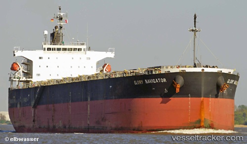
Vessel Glory Navigator IMO: 9336907, MMSI: 370937000 Bulk Carrier
UTC, 25.00205, 55.06443, course: 43, speed: 0
UTC, 25.00200, 55.06448, course: 43, speed: 0
2026-02-12 11:29:10 UTC, 25.00203, 55.06445, course: 43, speed: 0
Live AIS position:
UTC. Near Jebel Ali Free Zone),
updated 2026-02-12 11:29:10 UTC.
Find the position of the vessel Glory Navigator on the map. The latter are known coordinates and path.
marine traffic ship tracker show on live map
The current position of vessel Glory Navigator is 25.00203 lat / 55.06445 lng. Updated: 2026-02-12 11:29:10 UTCDetails:
Last coordinates of the vessel:
UTC, 25.00200, 55.06443, course: 43, speed: 0UTC, 25.00205, 55.06443, course: 43, speed: 0
UTC, 25.00200, 55.06448, course: 43, speed: 0
2026-02-12 11:29:10 UTC, 25.00203, 55.06445, course: 43, speed: 0