 vesseltracker.com
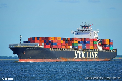
Vessel NYK DAEDALUS IMO: 9337614, MMSI: 319200700 Container Ship
UTC, 34.20065, 137.53384, course: 174, speed: 0.8
UTC, 34.18521, 137.51266, course: -1, speed: 1.2
2026-02-26 02:28:31 UTC, 34.15700, 137.48604, course: -1, speed: 11
Live AIS position:
UTC. 34 nm S of Kosai),
updated 2026-02-26 02:28:31 UTC.
Find the position of the vessel NYK DAEDALUS on the map. The latter are known coordinates and path.
marine traffic ship tracker show on live map
The current position of vessel NYK DAEDALUS is 34.15700 lat / 137.48604 lng. Updated: 2026-02-26 02:28:31 UTCCurrently sailing under the flag of Cayman Islands
NYK DAEDALUS built in 2007 year
Deadweight:
65867 tDetails:
Last coordinates of the vessel:
UTC, 34.22913, 137.59673, course: 171, speed: 1.6UTC, 34.20065, 137.53384, course: 174, speed: 0.8
UTC, 34.18521, 137.51266, course: -1, speed: 1.2
2026-02-26 02:28:31 UTC, 34.15700, 137.48604, course: -1, speed: 11