 vesseltracker.com
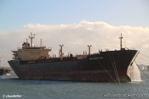
Vessel MARIGOLD IMO: 9339624, MMSI: 525103020 Oil/Chemical Tanker
UTC, -8.51743, 115.55248, course: 277, speed: 0.3
UTC, -8.51671, 115.54932, course: 113, speed: 0.1
2026-03-25 00:11:38 UTC, -8.51955, 115.55119, course: 343, speed: 0.1
Live Vessel MARIGOLD Analytics (details, animations, etc.)
Live AIS position: UTC. Near MANGGIS), updated 2026-03-25 00:11:38 UTC.Find the position of the vessel MARIGOLD on the map. The latter are known coordinates and path.
marine traffic ship tracker show on live map
The current position of vessel MARIGOLD is -8.51955 lat / 115.55119 lng. Updated: 2026-03-25 00:11:38 UTCCurrently sailing under the flag of Indonesia
Details:
Last coordinates of the vessel:
UTC, -8.51799, 115.55260, course: 288, speed: 0.1UTC, -8.51743, 115.55248, course: 277, speed: 0.3
UTC, -8.51671, 115.54932, course: 113, speed: 0.1
2026-03-25 00:11:38 UTC, -8.51955, 115.55119, course: 343, speed: 0.1