 vesseltracker.com
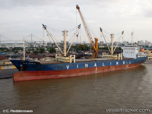
Vessel Tay Son 2 IMO: 9343041, MMSI: 574294000 General Cargo Ship
UTC, 3.25742, 113.07195, course: 97, speed: 0
UTC, 3.25745, 113.07192, course: 97, speed: 0
2026-02-09 23:50:03 UTC, 3.25755, 113.07195, course: 97, speed: 0.1
Live AIS position:
UTC. Near BINTULU),
updated 2026-02-09 23:50:03 UTC.
Find the position of the vessel Tay Son 2 on the map. The latter are known coordinates and path.
marine traffic ship tracker show on live map
The current position of vessel Tay Son 2 is 3.25755 lat / 113.07195 lng. Updated: 2026-02-09 23:50:03 UTCDetails:
Last coordinates of the vessel:
UTC, 3.25744, 113.07196, course: 97, speed: 0UTC, 3.25742, 113.07195, course: 97, speed: 0
UTC, 3.25745, 113.07192, course: 97, speed: 0
2026-02-09 23:50:03 UTC, 3.25755, 113.07195, course: 97, speed: 0.1