 vesseltracker.com
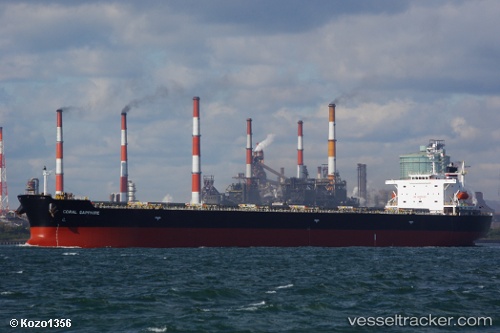
Vessel SHENG AN YANG IMO: 9343302, MMSI: 414531000 Bulk Carrier
UTC, 20.83150, 86.97002, course: 16, speed: 0
UTC, 20.83152, 86.96998, course: 16, speed: 0
2026-03-24 20:15:29 UTC, 20.83147, 86.97003, course: -1, speed: 0
Live Vessel SHENG AN YANG Analytics (details, animations, etc.)
Live AIS position: UTC. Near DHAMRA), updated 2026-03-24 20:15:29 UTC.Find the position of the vessel SHENG AN YANG on the map. The latter are known coordinates and path.
marine traffic ship tracker show on live map
The current position of vessel SHENG AN YANG is 20.83147 lat / 86.97003 lng. Updated: 2026-03-24 20:15:29 UTCCurrently sailing under the flag of China Peopless Republic
SHENG AN YANG built in 2006 year
Deadweight:
76627 tDetails:
Last coordinates of the vessel:
UTC, 20.83157, 86.96997, course: -1, speed: 0UTC, 20.83150, 86.97002, course: 16, speed: 0
UTC, 20.83152, 86.96998, course: 16, speed: 0
2026-03-24 20:15:29 UTC, 20.83147, 86.97003, course: -1, speed: 0