 vesseltracker.com
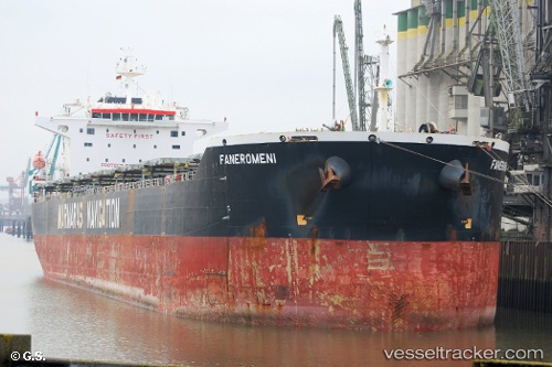
Vessel FANEROMENI IMO: 9343857, MMSI: 636021968 Bulk Carrier
UTC, 52.53342, 4.26638, course: 170, speed: 0.1
UTC, 52.53358, 4.26622, course: 180, speed: 0.4
2026-02-16 00:01:37 UTC, 52.53312, 4.26852, course: 214, speed: 0.3
Live AIS position:
UTC. 12 nm W of Ijmuiden),
updated 2026-02-16 00:01:37 UTC.
Find the position of the vessel FANEROMENI on the map. The latter are known coordinates and path.
marine traffic ship tracker show on live map
The current position of vessel FANEROMENI is 52.53312 lat / 4.26852 lng. Updated: 2026-02-16 00:01:37 UTCCurrently sailing under the flag of Liberia
FANEROMENI built in 2007 year
Deadweight:
92485 tDetails:
Last coordinates of the vessel:
UTC, 52.53340, 4.26560, course: 191, speed: 0.5UTC, 52.53342, 4.26638, course: 170, speed: 0.1
UTC, 52.53358, 4.26622, course: 180, speed: 0.4
2026-02-16 00:01:37 UTC, 52.53312, 4.26852, course: 214, speed: 0.3