 vesseltracker.com
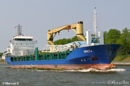
 VERTOM THEA
Current Status
Where is the vessel?
VERTOM THEA is currently in 31 nm E of Hillsboro Beach, based on AIS data received about 2h ago.
Latest AIS update:
Current position: 26.23945° N, 79.49103° W (31 nm E of Hillsboro Beach)
Average speed (last 7 days): Loading…
Average speed (last 30 days): Loading…
Vessel profile: VERTOM THEA is a General Cargo Ship with dimensions 101m x 15m.
This page combines live AIS, route history, probable destination signals, nearby traffic, and port activity for practical vessel monitoring.
The current position of vessel VERTOM THEA is 26.23945 lat / -79.49103 lng. Updated: 2026-03-25 16:02:45 UTCNearest reference points:
- Near Fort Lauderdale
- 44 nm E of Surfside
- Near Hillsboro Beach
Currently sailing under the flag of Luxembourg ![]()
VERTOM THEA built in 2007 year
Deadweight:
4470 tDetails:
Live Vessel VERTOM THEA Analytics (details, animations, etc.)
Recent AIS points (UTC):
2026-03-25 09:53:08 UTC · 26.07293, -80.11778 · SOG 0 kn · COG 91°2026-03-25 11:23:06 UTC · 26.07291, -80.11775 · SOG 0 kn · COG 89°
2026-03-25 14:26:46 UTC · 26.13782, -79.82693 · SOG 12.3 kn · COG 82°
2026-03-25 16:02:45 UTC · 26.23945, -79.49103 · SOG 11.3 kn · COG 82°