 vesseltracker.com
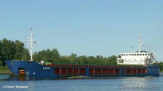
Vessel Shair Sabir IMO: 9348326, MMSI: 423059100 General Cargo Ship
UTC, 41.52333, 52.57167, course: -1, speed: 0
UTC, 41.52333, 52.57167, course: -1, speed: 0
2026-02-26 23:50:47 UTC, 41.52333, 52.57167, course: -1, speed: 0
Live AIS position:
UTC. Near Bekdash),
updated 2026-02-26 23:50:47 UTC.
Find the position of the vessel Shair Sabir on the map. The latter are known coordinates and path.
marine traffic ship tracker show on live map
The current position of vessel Shair Sabir is 41.52333 lat / 52.57167 lng. Updated: 2026-02-26 23:50:47 UTCCurrently sailing under the flag of Azerbaijan
Shair Sabir built in 2006 year
Deadweight:
5509 tDetails:
Last coordinates of the vessel:
UTC, 41.52333, 52.57167, course: -1, speed: 0UTC, 41.52333, 52.57167, course: -1, speed: 0
UTC, 41.52333, 52.57167, course: -1, speed: 0
2026-02-26 23:50:47 UTC, 41.52333, 52.57167, course: -1, speed: 0